CURRENT AFFAIRS | 13 JUNE 2026
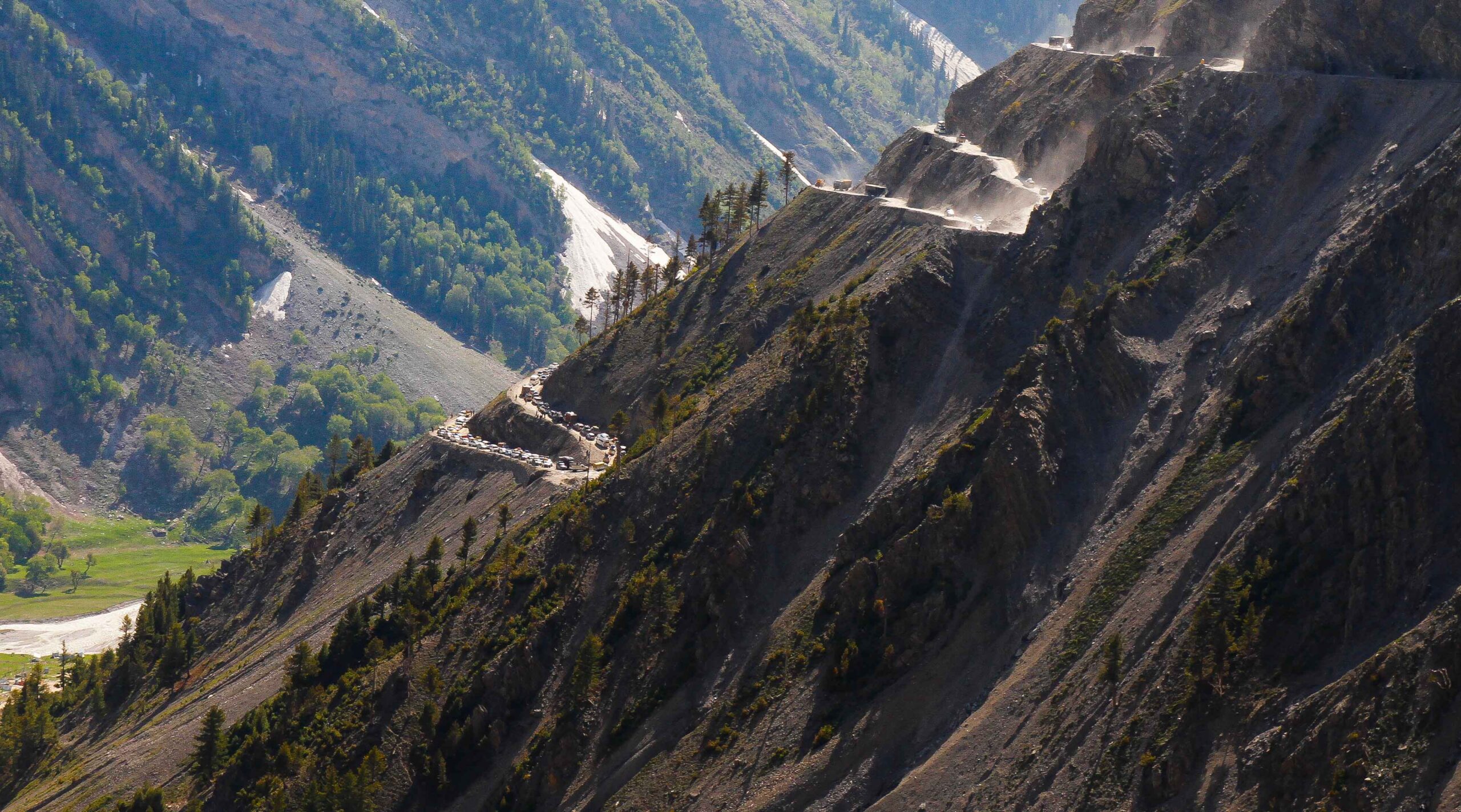
The Zojila tunnel — set to be the world’s longest high-altitude road tunnel — has achieved a construction ‘breakthrough’, with the excavation phase now complete. The 13.14-km tunnel connects Baltal (near Sonamarg in Kashmir) to Minamarg (near Drass in Ladakh’s Kargil district) at an altitude of about 11,578 feet, bypassing the notoriously treacherous Zojila pass.
Once operational, it will provide all-weather connectivity to Ladakh, which is currently cut off for nearly six months a year by heavy snow. The strategic payoff is significant: it boosts military mobility along the Line of Actual Control (LAC) with China and the Line of Control (LoC) with Pakistan. The tunnel is part of the roughly Rs 6,800-crore Z-Morh plus Zojila project, executed by the NHIDCL, with completion targeted for September 2026.
Foundation work began in 2018 but was delayed by the Covid pandemic and a 2024 terror attack on workers. The companion Z-Morh tunnel was opened earlier, and together the two will cut the Sonamarg–Drass journey by about 27 km.
Constitutional / Legal Framework
Strategic infrastructure of this kind connects to several constitutional and governance themes. Ladakh became a Union Territory (without legislature) on 31 October 2019 following the reorganisation of Jammu & Kashmir and the abrogation of the special status under Article 370 — reorganisation effected through the Jammu and Kashmir Reorganisation Act, 2019. Border-area development engages Article 1 (Union and its territory), the Union’s exclusive power over defence and the armed forces (Union List), and the doctrine of dual-use connectivity (civilian roads serving military logistics) along the LAC and LoC.
CLAT Angle
CLAT favours strategic-geography and border-infrastructure questions. Memorise the endpoints (Baltal–Minamarg), the length (13.14 km), the executing agency (NHIDCL), and the constitutional fact that Ladakh is a UT without a legislature post Article 370. Expect linkage questions on the LAC (China) versus the LoC (Pakistan) and dual-use connectivity.
Key Facts
| Distinction | World’s longest high-altitude road tunnel |
| Length | 13.14 km |
| Connects | Baltal (Sonamarg) ↔ Minamarg (Drass, Kargil) |
| Altitude | ~11,578 feet; bypasses Zojila pass |
| Project cost | ~Rs 6,800 crore (Z-Morh + Zojila) |
| Executing agency | NHIDCL; completion target September 2026 |
| Strategic value | All-weather access to Ladakh; military mobility along LAC & LoC |
Mnemonic / Memory Hook
“Zojila joins Baltal to Minamarg, beating the snow for six months.” Remember the length as “13.14 — like the date 13th, then 14”, and that NHIDCL = National Highways Infrastructure Development Corporation Limited.
Why this matters for CLAT 2027
Strategic and defence infrastructure is a recurring CLAT theme because it blends geography, current affairs, and constitutional law. A candidate who can place the Zojila tunnel on the map, recall its role in military mobility along the LAC and LoC, and connect Ladakh’s UT status to the post-Article 370 reorganisation will be well-positioned across the GK and legal-reasoning sections of CLAT 2027.
Practice Quiz — 10 CLAT-Style Questions
Click an option to reveal the answer and explanation.